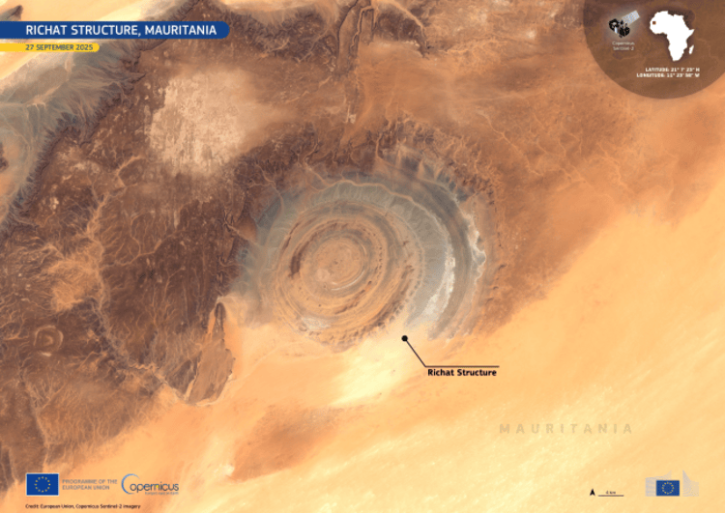
The Richat Structure, a remarkable circular geological formation located in the Sahara Desert of central Mauritania, stands among the most distinctive landforms visible from space. Spanning roughly 40 kilometres in diameter, the formation—commonly known as the “Eye of the Sahara”—features a series of concentric rings composed of exposed sedimentary rock.
Initially believed to be the result of a meteorite impact, scientists now understand the Richat Structure as a deeply eroded geological dome, shaped through uplift and prolonged erosion over millions of years. Its unique circular pattern and geological complexity have made it a key subject of study for geologists and planetary scientists alike.
The formation is prominently captured in this Copernicus Sentinel-2 image acquired on 27 September 2025. The Sentinel-2 satellites, part of the European Union’s Copernicus Programme, continue to play an essential role in monitoring remote and ecologically significant regions around the world. By delivering high-resolution imagery and crucial environmental data, these satellites enable scientists to track geological changes, assess natural processes, and deepen understanding of Earth’s most extraordinary features.


